


Construction access. The site may be reached by a 3-hour hike via the Bamforth Ridge or Montroe-Alpine-Long Trails. Contact John Buddington for the exact route. A shorter, but wetter access is possible from the gated forest road into Honey Hollow.
The access trail parallels Gleason Brook to the east. At a well-flagged intersection, a cross trail goes left directly towards Gleason Brook. The lodge site is about 100 yards west. A few birch logs and a rusted stove are visible at the site. The brook is a few feet downhill and perhaps 25 yards further west. The privy site is a few yards east of the cross-trail junction.
Permanent access. The most direct route to the Long Trail goes directly east from the site and climbs Bamforth Ridge. This route is 0.4 miles by map and ascends about 300 feet.
These photos were taken by Bill C on 4-Nov-01. The images have been shrunken from the original 600,000 bytes. Contact me if you want the complete image.
As can be seen, the site is relatively flat, dry, and marked by birch trees. The water source, being the same as Gorham Lodge, is permanent. The flatest area was once used as a hunting camp. A few rotted birch logs and an wood stove are all that remain.
|
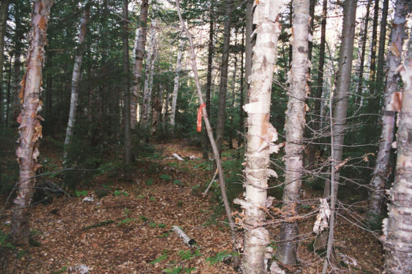
Cross trail junction, looking north. Note the size and color of the flagging tape. |
|
Cross trail junction, looking west towards the lodge site. |
|
Cross trail junction, looking south. |
|
The proposed lodge site, looking east. |
|
Remains of the wood stove. Note the mixture of leaves. |
|
Steve L's ear near the wood stove. |
|
Eric S makes a GPS reading looking north along Gleason Brook. |
|
Gleason Brook, upstream. There are bathtub-deep pools |
|
Gleason Brook, downstream. Note the rise on the west of the brook. |
|
Gleason Brook, further upstream. |
|
North from the lodge site. |
|
South from the lodge site. |
|
East from lodge site |
|
Remains of the hunting camp. Remnants of the stove are just behind Eric S. |